Total distance is a little less than 11.
See map of the portion of run on the Mt Vernon Trail from 395 south into Crystal City and to the turnaround:
Ft Scott Hill Map
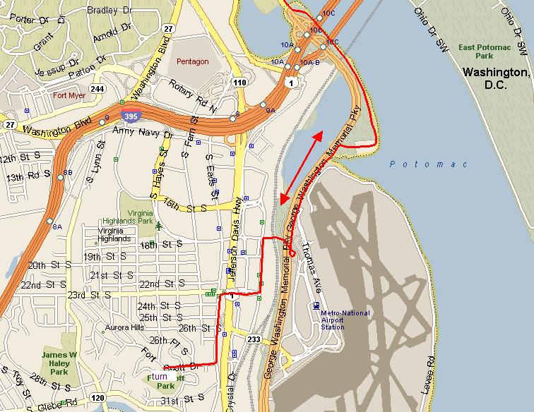
-- Start: Iwo Jima
-- From Iwo Jima follow bike path toward Memorial Bridge. (< 1 mile)
-- From Memorial Bridge follow Mt.Vernon trail south toward Reagan National Airport. (about 2.5 miles)
-- Near Airport (after 1st bridge, before 2nd bridge I think) exit onto Crystal City Connector Trail (about 0.25 miles)
-- At end of Crystal City Connector Trail, turn left (south) onto Crystal Dr. to 23rd St. (< 1 mile)
-- At 23rd St, turn right (west) to Eads St. Use tunnel to get under Jeff Davis Hwy (about 3 blocks).
-- At Eads St. turn left (south) to Fort Scott Drive (about 6 blocks).
-- At Fort Scott Drive, turn right (west) up the Hill (Enjoy the climb!!!)
-- Turn around at Fort Scott Park at the top of the hill and retrace your steps.
-- End: Iwo Jima Round trip distance is a little less than 11 miles. Intermediate distances are approximate.